



The United Nations General Assembly has overwhelmingly backed a new approach to mapping the world that more accurately reflects Africa’s true size, with the United States casting the only vote against the measure.
The General Assembly voted 164-1 on Friday (Sept. 4) to adopt the “Correct the Map” resolution, an initiative sponsored by Togo and supported by the African Union. Estonia, Georgia, Lithuania, Moldova, Serbia and Ukraine abstained.
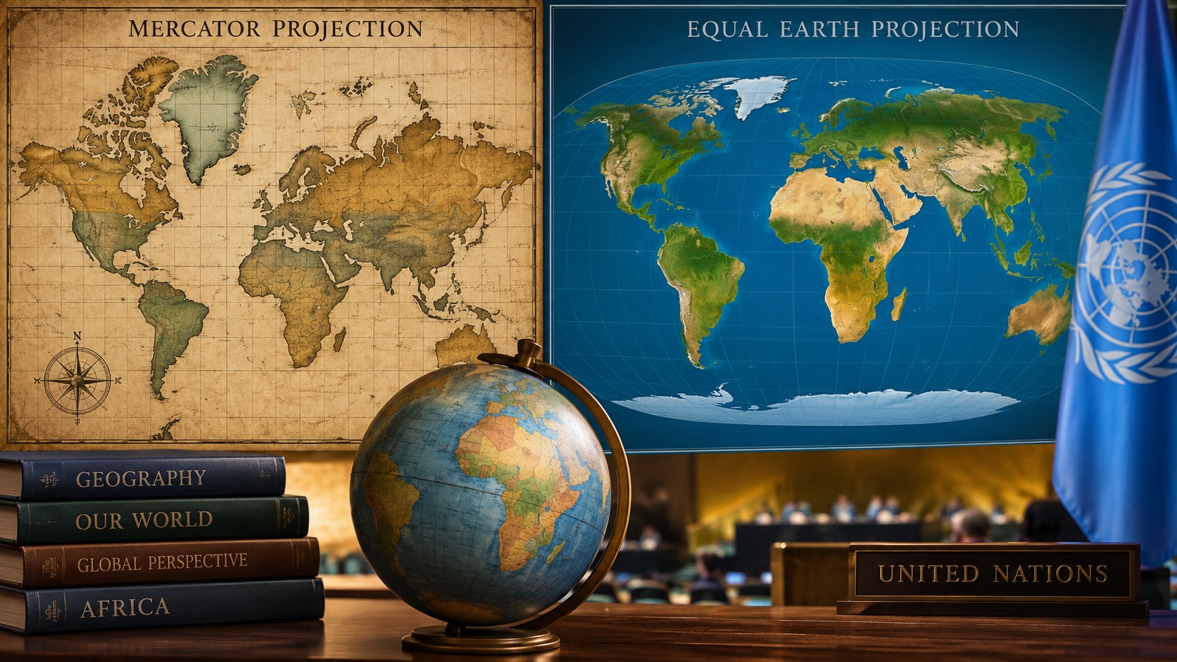
The resolution encourages governments, schools, international organizations, newsrooms and technology companies to move away from the centuries-old Mercator projection in favor of maps such as the Equal Earth projection.
“Maps shape our understanding of the world,” Togo Foreign Minister Robert Dussey said before the vote. “They guide education, nourish the imagination, and influence collective perceptions.”
Flemish cartographer Gerardus Mercator created the Mercator projection in 1569 to help sailors navigate. While useful for plotting courses at sea, the projection dramatically enlarges landmasses closer to the poles and reduces the apparent size of regions closer to the equator.
One of the most familiar examples is Greenland, which appears roughly the same size as Africa on many Mercator maps.
Africa is actually about 14 times larger.
Tom Patterson, a retired National Park Service cartographer and one of the creators of the Equal Earth projection, has questioned the continued use of Mercator maps outside navigation.
“If you’re using the Mercator map as a world map, say, in the classroom, students would just have a completely warped view of the size of countries in the world,” Patterson told NPR last year.
Africa No Filter, one of the organizations behind the campaign, celebrated the U.N. vote.
“We want to see accurate maps in schools, textbooks, newsrooms, businesses and on the digital platforms billions of people use every day,” the organization said.
French Foreign Minister Jean-Noël Barrot also welcomed the decision.
“Changing the map obviously doesn’t change the world,” Barrot wrote on X. “But correcting a representation that distorts it is already an act of truth.”
The Trump administration predictably rejected the effort, arguing that the debate went beyond cartography.
Yaryna Ferencevych, deputy U.S. representative to the U.N. Economic and Social Council, called the proposal part of a “much larger and more radical ideological project.”
“This resolution mocks the work and purpose of this institution,” said Ferencevych. “Instead of focusing on genuine problems of international peace, prosperity, or good relations, this body is debating map projects from the 16th century.” She added that resolutions promoting such an “ideological agenda” were “barnacles on our work here” and blamed initiatives like the map proposal for damaging the U.S.’s credibility.
Ukraine, meanwhile, said it supported correcting geographic distortions affecting Africa and other parts of the Global South but objected to how some maps using the projection represented Ukrainian territory occupied by Russia.
The resolution does not ban the Mercator projection or require countries to adopt Equal Earth but encourages projections that more accurately illustrate the relative size of the world’s landmasses.
“Correcting the map means correcting the way we see the world,” Dussey added.